Geospatial Expertise
Combining engineering experience, advanced geospatial technologies, and research-driven methodologies to support infrastructure and development projects.
Surveying & Geomatics
High-accuracy spatial data acquisition using GNSS, total stations, engineering surveying, topographic surveys, and geodetic control networks.
GIS & Spatial Intelligence
Spatial data management, geospatial analysis, decision support systems, asset management, and location intelligence.
Remote Sensing
Satellite imagery analysis, environmental monitoring, land-use assessment, change detection, and infrastructure applications.
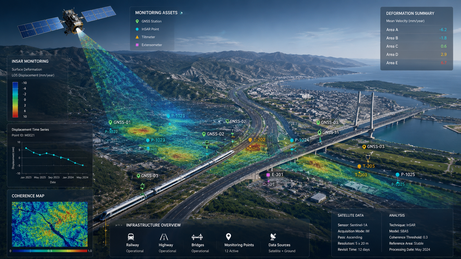
Infrastructure Monitoring
Ground deformation monitoring, structural movement assessment, displacement analysis, and infrastructure performance monitoring.
LiDAR & 3D Mapping
Mobile mapping, SLAM-based scanning, digital twins, 3D modeling, and reality capture technologies.
AI-Powered Geospatial Analytics
Machine learning and artificial intelligence for automated geospatial workflows, feature extraction, predictive analytics, and spatial intelligence.
Remote Sensing
Satellite imagery analysis, environmental monitoring, land-use assessment, change detection, and infrastructure applications.
Technology Stack
GNSS
GIS
Remote Sensing
InSAR
LiDAR
Artificial Intelligence
Spatial Databases
Digital Twins
Geospatial Analytics
Total Stations
Levels
Python Applications
GIS & Spatial Intelligence
Spatial data management, geospatial analysis, decision support systems, asset management, and location intelligence.
Why This Expertise Matters
Accurate geospatial information improves planning, design, construction, monitoring, and asset management decisions throughout the infrastructure lifecycle.
See Expertise in Action
Discover how our technical capabilities are transformed into practical solutions for infrastructure and development projects.
View Solutions