Remote Sensing
Using InSAR for Urban Subsidence Monitoring: Methods and Limitations
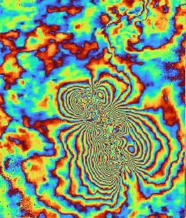
Ground deformation monitoring using satellite radar interferometry offers spatial coverage no ground sensor network can match — but understanding its limitations is essential for engineering use.
Read Article →
